

Building Enterprise GIS System for City Government, USA
Business Driver:
- To efficiently screen all utility jobs that impact the environment
- Reduce time spent coordinating projects and tracking down the environmental compliance info
- Centralized, efficient system to screen, manage, and document projects to demonstrate compliance
- Enhance project design process with GIS
Solution:
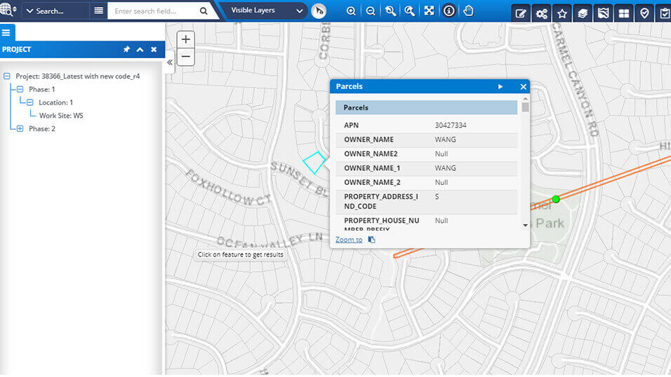
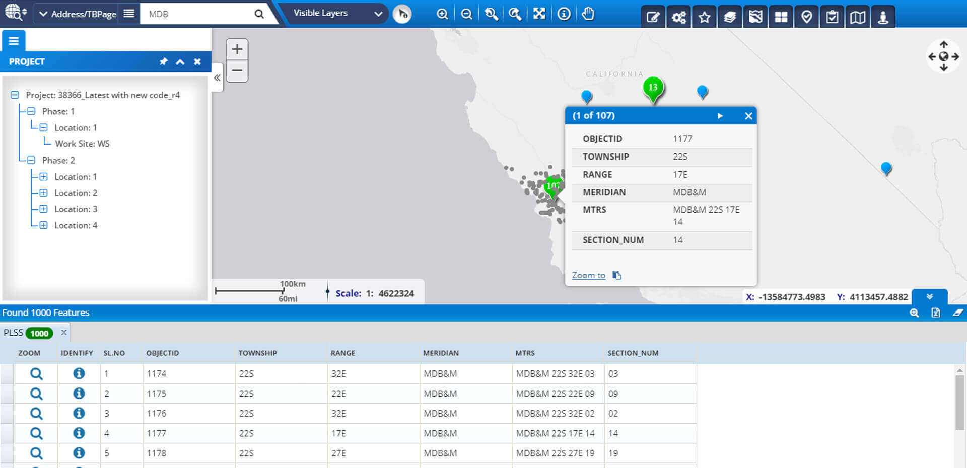
- Developed GIS portal for utility data analysis and assets management system
- Environmental project screening
- Location based risk assessment
- Automate business approval process
- Automate projects reports generation
- Integrate with different business system
- Spatial and non-spatial business rules configurations
- Integrate with portal for ArcGIS
Value Proposition:
- Reduce the operational risk
- Environmental team every day issuing tentatively 30+ Work Permits
- Saving tangibles amount of man hours and improve efficiency
- Comply with Environmental guidelines and regulation. It will avoid incidents and follow environmental regulations and complies
Technology:
- ESRI ArcGIS Enterprise, Microsoft .NET, CRM Integration
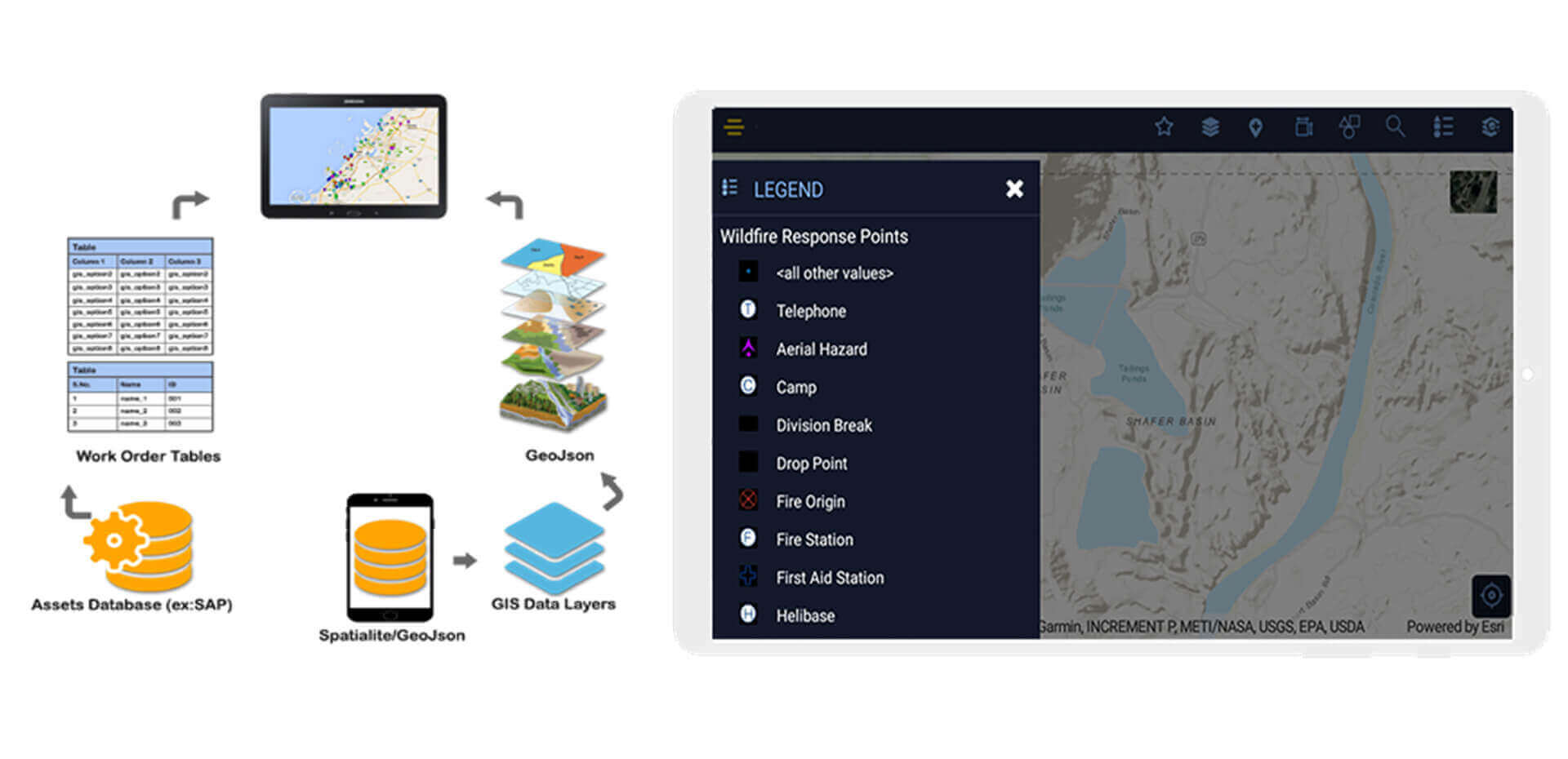
Field Survey and Assessment Mobile App

Key Features:
- View and fill the need assessment based on the countries and related emergency.
- View and fill the project aid data based on the countries and related emergency
- Real time GPS location.
- Attach photos, videos and other documents.
- Offline data capture.
- Review data attributes directly from the field.
- View and explore maps in the field.
- Ability to add the main GIS landmarks.
Technologies Used:
- Esri ArcGIS Desktop, ArcGIS Server, Portal for ArcGIS and Collector for ARCGIS,
- Programming: Java Script API, Mobile API, HTML-5, jQuery, ASP.NET.
- Database: SQL Server and ArcSDE
- Esri ArcGIS Desktop, ArcGIS Server, Portal for ArcGIS. Portal Widgets, Operations Dashboard.
- Programming: Java Script API, HTML-5, jQuery, ASP.NET and ArcObjects.
- Database: SQL Server and ArcSDE
Field Inspection Solution for Utility, USA

Business Driver:
- Spending lot of time for completing the field inspection
- Not able to generate compliance reports
- Multiple paper-based forms
Solution:
Automate the Field Inspection management Solution
- Create Dynamic Forms and Reports
- Alerts and configuration
- Automatic Business rules validation
Website: https://utilisync.com/
Value Proposition:
- Improve the operational efficiency
- Same time and easy to complete the field inspection process
- Automate Document Filling
- Be Audit Ready and complains with Utility Council
Technology:
- App Studio, QT, Android and IOS native Application
Mobile Field Inspection Solution
Business Driver:
- Location based work order management is relay save lot of time and efforts. SAP system doesn't have solution for allocating work based on the Zone area
Solution:
- Developed Mobile GIS Application works in Offline and Online for doing the field data collection and Spatial mapping analysis
- Extract the work orders details from SAP system, Zones Location details from the GIS system. It helps to plan the work order allocation and execution based on the Zones
- Work Offline and Online
- Data update automatically in both SAP and GIS system
Value Proposition:
- Increase the operational efficiency
- Easy to complete the field work order Execution process
Technology:
- AppStudio, QT, ESRI Android and IOS API, SAP integration
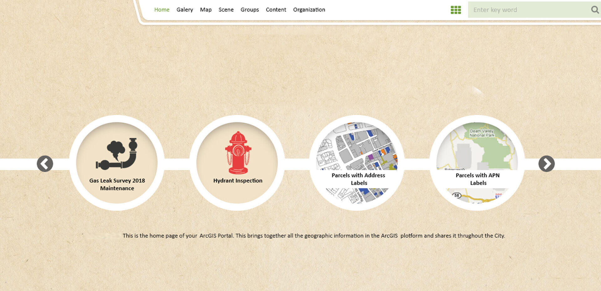
GIS Foundation Services for Utility, USA
Business Driver:
- City has legacy GIS desktop applications for each department (Land Records, Vegetation and Utilities)
- Different technologies used to implement the legacy GIS apps
- Not able to analyze the information in one platform
- No Citizen engagement web GIS Solutions, Open GIS data platform to share the information
Solution:
- Five Years GIS Strategic plan and Implementation Road Map
- Built Foundation GIS Environment
- Implementing Enterprise GIS Portal Solutions
- Geo Enabled Mobile Solution and Analytical dashboards
Value Proposition:
- Foster Operational decisions
- Easy of Citizens engagement
- Improved operational efficiency and service quality
Technology:
- ESRI ArcGIS Enterprise, Portal for ArcGIS, Microsoft .NET, Operations Dashboard
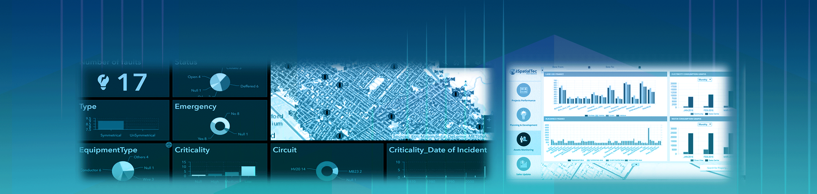
Outage Management Dashboard for City Government, Utility Department
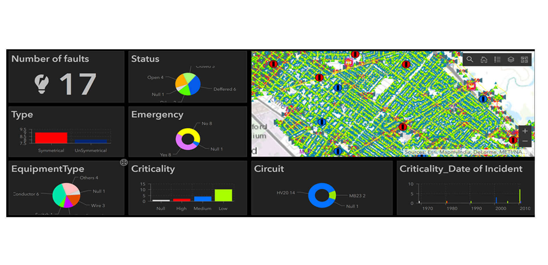
Business Driver:
- Lack of visual representation of Electrical outages / Faults are occurring in the City
- Difficult to locate the Faults / outage location and associated utility network information
- Visualizing the historical faults geographically to do the predictive analysis and taking some preventive measures
Solution:
- To Create a Web based Map application to collect the Electric Faults / Outages details with respect to the Status, Emergency, Criticality, Equipment Type, Type and Number of Faults graphical of the required location
- Build an Operational dashboard to display the Map with the Locations affected by the Electrical Faults with the KPI
Value Proposition:
- Quickly take the Corrective Action by visualizing the outage locations on the maps
- Field people can reach to the location quickly
- Good visibility for the management about the outages. Based on the historical data, management can plan preventive measures
Technology:
- ESRI ArcGIS Enterprise, Microsoft .NET, Operations Dashboard